Storm Force North-Westerlies

4th April 2021

Covid -19
The Scottish Avalanche Information Service issues information to support permitted activity under current Scottish Government guidance.
Please be aware of current mandatory travel restrictions in Local Authority areas within Scotland and respect local communities by referring to Scottish Government guidance and safe route choices for exercise. For further guidance please refer to the following information for hillwalkers and climbers and snowsports on ski and board.
This blog is intended to provide hazard and mountain condition information to help plan safer mountain trips.
A bright sunny day this morning, but it was already difficult battling into Coire an t-Sneachda in the wind. As forecast the wind increased through the day, with extensive cloud building quickly ahead of the approaching cold front.
This cold front will bring in a cold Arctic Maritime airstream, with light snow expected above 200 metres for the duration of the forecast period. The winds will remain from the North-West depositing new accumulations of Windslab on South and South-east aspects. Instabilities are likely due to the cold temperatures particularly where windslab overlies the existing older snowpack, or where it achieves depth.
In short, it is going to be a cold, windy and unsettled for the next few days.

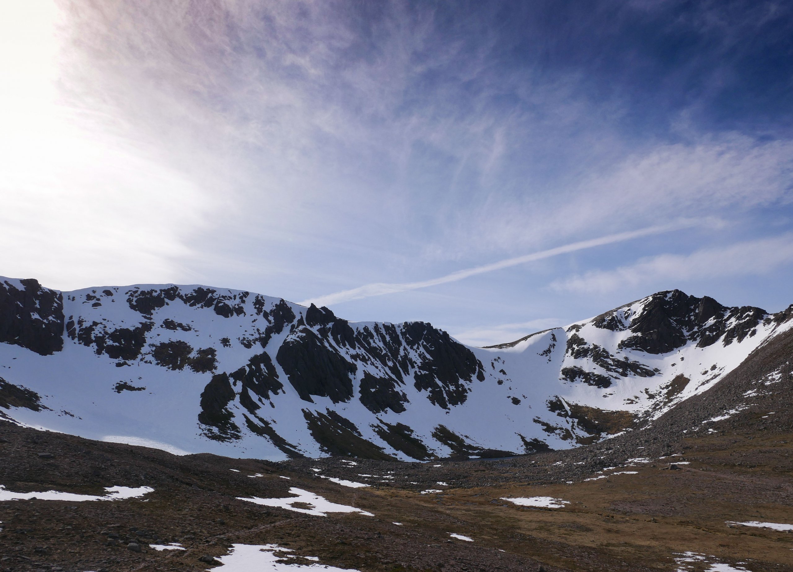
Looking into Coire an t-Sneachda. The wind was already howling over the plateau with characteristic booms so I made a hurried retreat from the coire as the wind increased.


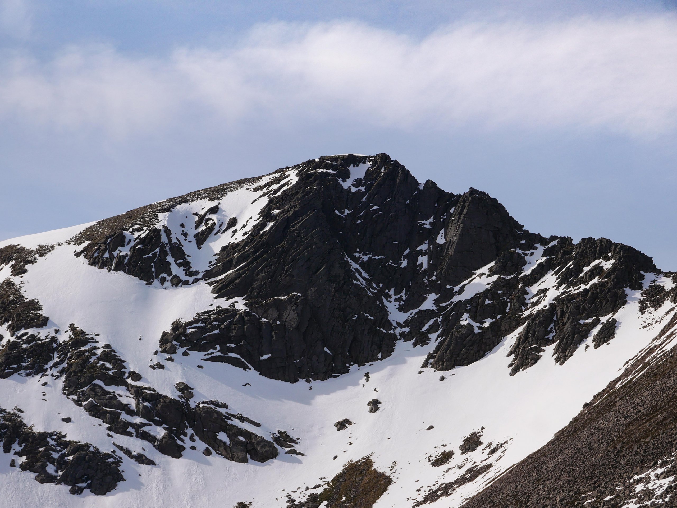
The Fiacaill Buttress, Coire an t-Sneachda


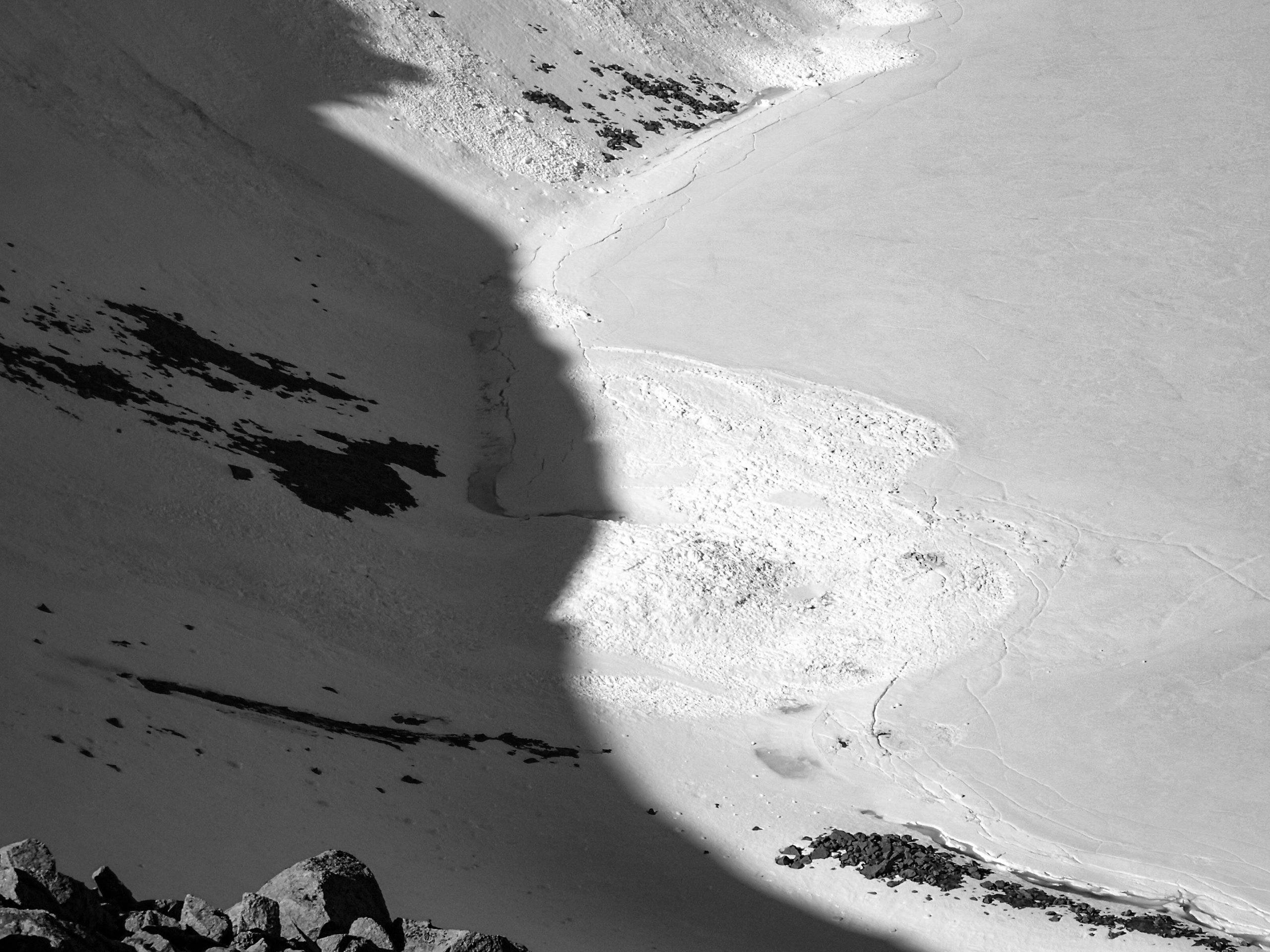
This avalanche was submitted to the SAIS database yesterday. Large Size 2 (possibly 3) in Coire an Lochain on Braeriach. This is most likely to have occurred during the avalanche cycles around the 20-22 February or 9-10 March. Keen to get up there and have a look. Please do report avalanches even if you are unsure of the details, it is greatly appreciated. You can do so here at https://www.sais.gov.uk/report_avalanche/ [Image Credit: Jenny Allen].


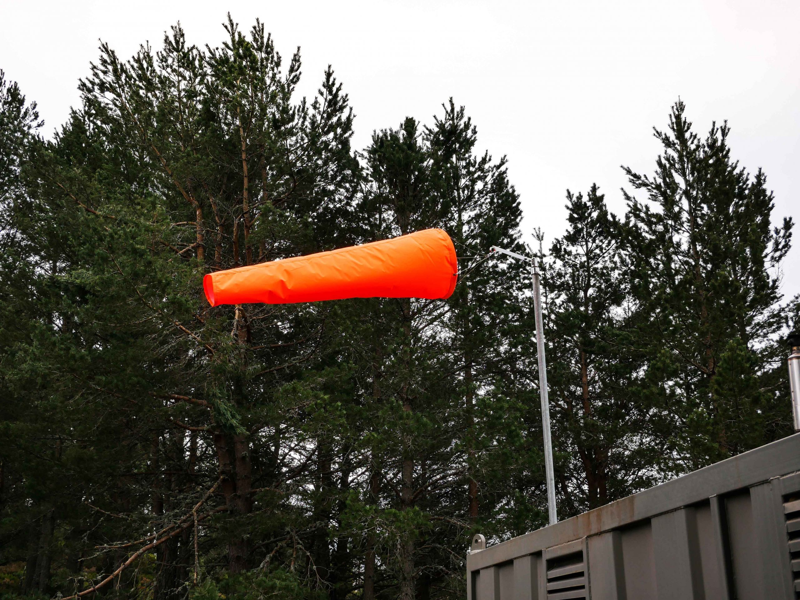
Let’s talk windsocks! Often overlooked, these are a very useful guide to wind direction and windspeed. Most windsocks that meet the CAA specifications indicate a 15 knot windspeed or greater. So about 17 mph or 28 km/hr. So here at Glenmore Lodge this afternoon the wind was Westerly >15 knots. While on Cairngorm the maximum gust recorded was 93 mph. More details on windsock specification at https://www.skybrary.aero/index.php/Windsock

Comments on this post

Got something to say? Leave a comment

    Latest Northern Cairngorms Avalanche Report
    Archives
    Categories
    RSS Feed
    Keep up to date by subscribing to our RSS feed
Service funded by sportscotland
Forecast data supplied by the Met Office
SAIS Sponsors