Blizzard conditions
6th March 2023
Unstable windslab is building on East to South aspects above 800m, on top of the crust mentioned in yesterday’s blog. The unstable windslab is becoming more widespread and increasingly hazardous.
Check out our Instagram feed for more information at https://instagram.com/scottishavalancheservice?igshid=YmMyMTA2M2Y= @scottishavalancheservice
Blizzard and white out conditions were experienced today. There was significant drifting of new snow and very few rocks left exposed at higher elevations to provide definition.
Snowfall, at all levels, is set to continue through tomorrow. Heavy snowfall combined with very strong North-Westerly winds, means that unstable windslab will continue to develop and become more extensive. Avalanches are likely on East to South aspects above 800m.
Blizzard and whiteout conditions are expected again tomorrow, before a sunny day expected on Wednesday. It is forecast to remain cold.
View this post on Instagram

Navigation was challenging today as the landscape has turned much whiter with many more rocks on the plateau covered in rime and snow, reducing definition. This photo was taken during a brighter moment.
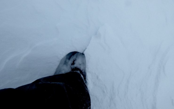
A shooting crack within the fresh unstable windslab.
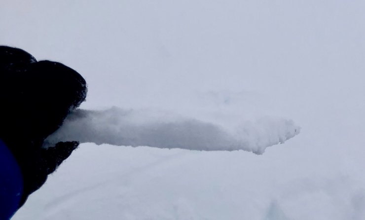
The crust mentioned yesterday, which is now buried under fresh unstable windslab.

A brighter moment gave a view of Creagan Gorm (732m) on the left and Meall a’Bhuachaille (810m) on the right, with the next snow shower approaching. A couple of hours after this photo was taken, there was a blanket of fresh snow lying at all levels.
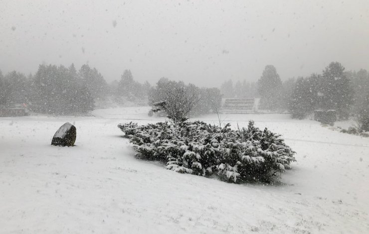
The view outside the office at 4pm this afternoon.
Comments on this post
Got something to say? Leave a comment


Matt Dalby
6th March 2023 10:54 pm
In March 2006 is was doing Winter ML assessment at Glenmore Lodge and there was a similar weather pattern i.e. Northerly winds and heavy snow. By the end of the week there was 50cm of snow in the car park. I wonder how much there’ll be by the end of this week.
David Woods
7th March 2023 11:30 am
Excellent video. Thanks
ncairngormsadmin
7th March 2023 5:46 pm
Hi David
Thank you. Its a good way to get the message across when we have a complex snowpack.
craig
8th March 2023 1:55 pm
That video is really helpful.