Snow on the Horizon
11th December 2023
Another dull and cloudy day in the Northern Cairngorms area today. At 9am the freezing level was around 1000 metres, although it fell later. A light dusting of snow fell overnight, with some very light precipitation later.
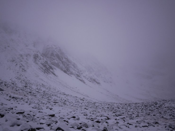
Despite the visibility Coire an t-Sneachda looked wintery, with the higher crags looking cosmetically white at least.
Easterly winds should bring snow showers tomorrow although amounts are uncertain as a front tracks north into the highlands. Correspondingly, the greatest amounts of snow are expected in the Southern Cairngorms and the south east extremity of the Northern Cairngorms area. Fresh poorly bonded windslab accumulations are to be expected on South-West, West and North-West aspects above 850 metres.

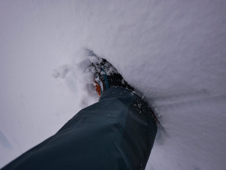
Foot penetration in a moist and slowly consolidating snowpack. This was early in the day at around 900 metres. Crampons were useful a little higher in firmer snow above 1000 metres.

A light dusting of overnight snow in Coire an t-Sneachda. The freezing levels came down during the day, maintaining the cosmetic white cover to the crags (in their upper half at least).
Comments on this post
Got something to say? Leave a comment


Danny Barden
11th December 2023 6:07 pm
I appreciate it’s early in the season but I’ve noticed that the avalanche forecast/information for the previous day(s) isn’t showing at the top of the page at the moment unlike in previous years. Is this a deliberate change or will the ‘normal service’ be resumed in due course?
ncairngormsadmin
11th December 2023 10:09 pm
Hi Danny, Thanks for the message and I am assuming you are referring to the horizontal bar at the top of the Avalanche Report page? If so you are quite right, this is a deliberate change following our some cursor heat mapping, review of analytics and a study into risk perception which was conducted by researchers in Tromsø in conjunction with the Norwegian avalanche service (VARSOM). There will most likely be a small piece explaining that change coming soon after the season start. Archive forecast information will still be available in a different format, and in a different place (probably under the ‘more’ tab). You might also notice that the ‘Avalanche Problems’ are now at the top of the page giving them greater prominence…
ncairngormsadmin
13th December 2023 3:42 pm
In addition to the above comment – there is clear evidence that a trend bar which presents the avalanche hazard over time significantly effects perception of current hazard- eg if a period of low hazard over a number of days precedes a moderate hazard (or mod to considerable) then the higher hazard is not considered as important as it should be. The facility to look at past avalanche forecasts will be located in the forecast archive and will be presented as a monthly gallery of icons in the near future.