Windslab Development
28th February 2024
Another day of high winds in the Northern Cairngorms, made progress particularly difficult. Regular blog readers (or viewers) will need little introduction to the infernal nature of southerly winds.
As these winds get compressed over the plateau they accelerate down the north facing downslopes creating gusts which are often far beyond the posted values expected in local weather forecasts. Further to that, you might notice in the snow profile that the summit weather records winds of 45 mph from 259 degrees (~WSW). This figure often seems to be well below the winds that can be experienced in Coire Cas and Coire an t-Sneachda, potentially given the extra 100-150m above the plateau. An additional reason is that the value given above is actually the mean over a 24 hour period.
The wind has transported all of the soft snow leaving the plateau and wind exposed slopes scoured and frankly bare. Correspondingly, East facing slopes and later North to East have accumulated windslab. Due to the ferocity of the wind this is generally to be found in steep wind sheltered locations or close to sharp coire rims. Elsewhere there are unsupported bulges of windslab which have been deposited mid slope due to recirculating and down-draughting winds.
A transient thaw will occur overnight which will improve stability slightly, before colder temperatures and windslab development resumes through tomorrow. The Avalanche Hazard will be Moderate.
Behind the headline avalanche hazard there are two ‘avalanche problems’ in the report for tomorrow:
![]() Windslab: Development of windslab will occur from early in the morning as the freezing level drops. These will be isolated and shallow initially, but will build in depth and extent as the day goes on. Given good visibility you will be able to “see and avoid” in steep terrain.
Windslab: Development of windslab will occur from early in the morning as the freezing level drops. These will be isolated and shallow initially, but will build in depth and extent as the day goes on. Given good visibility you will be able to “see and avoid” in steep terrain.
![]() Persistent Weak Layer: Weaknesses in the snowpack are persisting at depth on North to East aspects above 1000 metres. Buried surface hoar exists within a low density layer, above the older melt-freeze snowpack. This will remain sensitive to additional loading overnight, but will slowly stabilise in colder conditions. This layer is reasonably deep in the snow pack, which makes triggering difficult unless there is a high additional load (e.g. a group of walkers or skiers). Be extra cautious in steep areas at the transition from a thin to deep snowpack.
Persistent Weak Layer: Weaknesses in the snowpack are persisting at depth on North to East aspects above 1000 metres. Buried surface hoar exists within a low density layer, above the older melt-freeze snowpack. This will remain sensitive to additional loading overnight, but will slowly stabilise in colder conditions. This layer is reasonably deep in the snow pack, which makes triggering difficult unless there is a high additional load (e.g. a group of walkers or skiers). Be extra cautious in steep areas at the transition from a thin to deep snowpack.
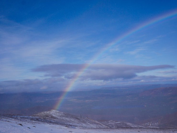
Difficult progress today in Coire Cas. This image is taken with the wind behind, the rainbow created due to melting snow blown into the air at lower elevations.
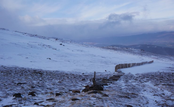
I left the coire so as not to resemble this snow fence – supine, broken and blasted by the wind in Coire Cas.
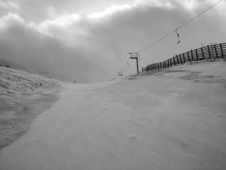
The Gun Barrel, moist windblown snow was being blown down to lower elevations such as here at around 850 metres in the ski area.
Late on the 27th Feb a human triggered avalanche was reported in Ciste Mhearad to the East of the Ptarmigan. A group of five people were involved, three were carried down and one buried to the waist thankfully without injury. Ciste Mhearad always accumulates snow in westerly and south-westerly winds due to the ‘fetch’ of the plateau. This makes the location a reliable and snow sure spot for snow holing and winter skills parties, but it also steep. There have been two avalanches reported here this season. Thanks to both parties for reporting these events, while nobody would want to advertise the fact, events like these provide SAIS with useful confirmation of stability (or instability).
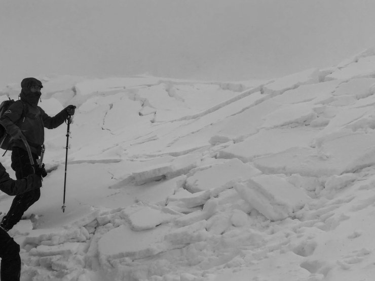
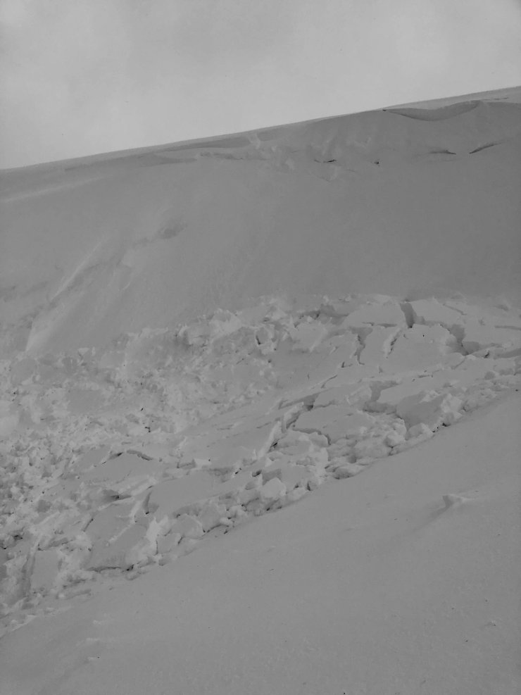
An image taken by a Glenmore Lodge party later, gives some scale to the windslab.
Comments on this post
Got something to say? Leave a comment