New and Unstable Snow.
3rd March 2024
After some overnight precipitation (rain in the glens, snow on the hill) it turned out to be a pleasant day at lower levels. However, at higher levels it was a very different story. There was a cloud cap on the summits all day and there was lots of snow drifting in the strong SSE winds. Where this drifting snow was being deposited on top of the soft powdery snow that fell yesterday it produces an unstable combination. Although the areas where this occurred at not extensive, they are not well bonded. 
The view up the hill this morning. The summits were covered in cloud while the glens were enjoying some sunshine. This combination is not unusual when the wind is from the South-East or South-South-East. Drifting snow could be seen even from this distance on the ridge catching the sunshine.
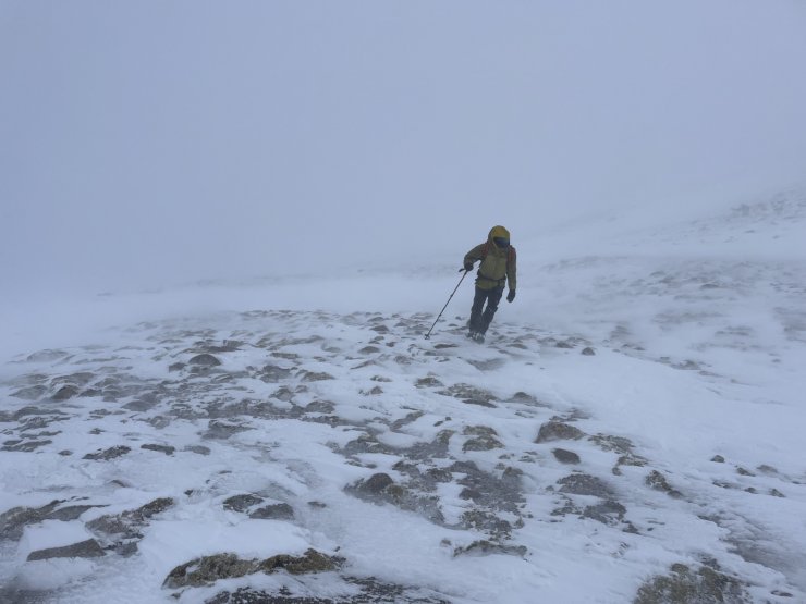
When on the hill winds were quite strong. Here a walker leans into the wind near the summit of Coire Cas. It was probably sunny and clear just a few few kilometres away down at the Cas carpark when this photo was taken.

Signs of instability. In this case the end of my ski pole made contact with a fresh cornice, and the whole thing collapsed.

Signs of instability number two. In this case just walking above an area where the slab had been cleared, and significant cracking and shear failure of the slab occurred.
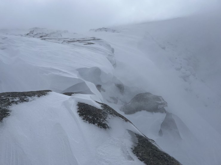
Fresh cornices and windslab forming at windy col. Although not snowing at the time drifting snow could be seen piling in there. The fresh deposits are not particularly extensive, but is in general poorly bonded.

Looking back to Coire an Lochan in the early afternoon. The weather had cleared a bit, but the tops were still in a bank of cloud.
Comments on this post
Got something to say? Leave a comment