Spaceships…
21st March 2025
All change…
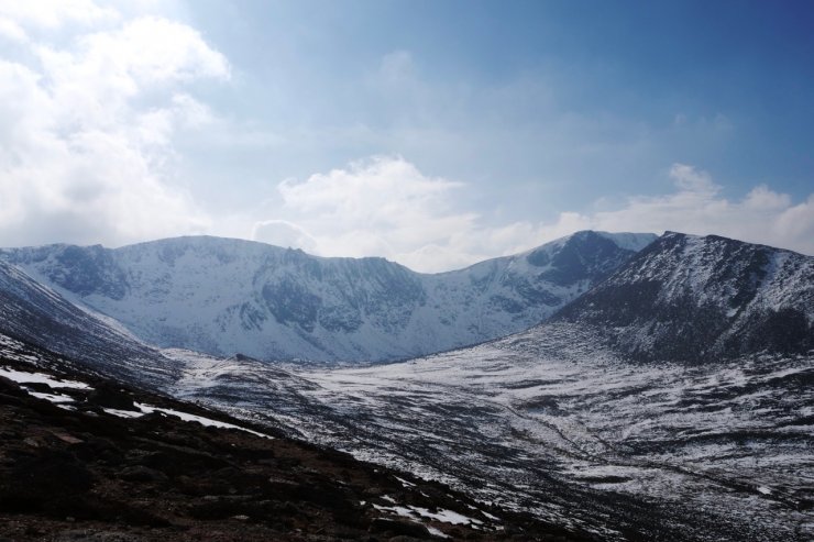
The dominant Scandinavian high pressure of last week has now given way to a low pressure system bringing very mild air and storm force Southerly winds to the Northern Cairngorms. After spending the last few days rattling across the Cairngorm plateau searching out the patches of snow that had been softened by the sun, today all the remaining snow was soft and becoming wet. Quite a lot of the snow patches on the lower slopes have already disappeared with the snow line having risen to around 850 metres, with the greatest accumulations still on East to South aspects above 1000 metres.
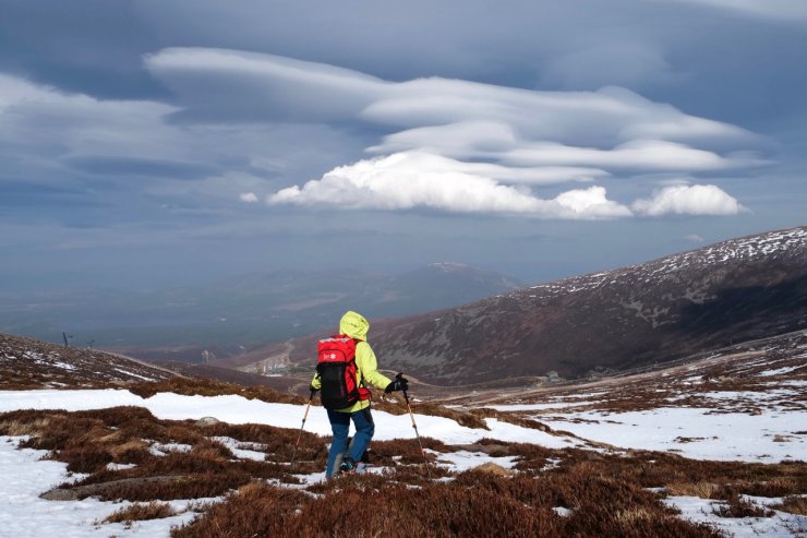
With the winds gusting around 80mph on the summit of Cairngorm we were confined to the lower, leeward slopes for our observations today. There was reasonable hazy visibility which made landscape photography quite challenging but the dominant attraction today were the amazing spaceship-like cloud formations caused by the storm force winds and the wing like shape of the Cairngorm plateau – a cloud spotters dream!
As the Southerly winds are squeezed over the smooth surface of the plateau a train of standing waves form in the air on the leeward side of the mountains. The moisture in the air condenses to form some very spectacular and dramatically shaped Lenticular clouds.
If you want to learn more about Lenticular clouds try this link: Lenticular clouds – Met Office
Sadly, we have quite a lot of rain in the forecast for tomorrow, which will further reduce the snow cover and will also produce some wet snow instabilities on steeper terrain on East through South to South-West aspects above 900 metres. The outlook remains mild for the following week.

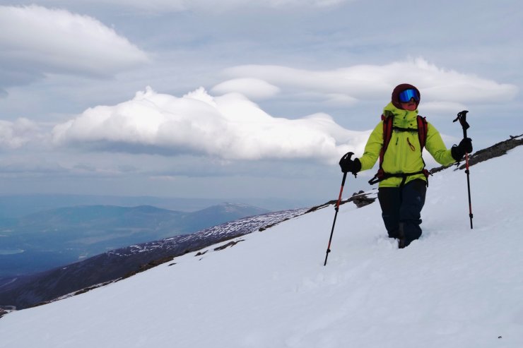
“Like some alien beast” – Lenticular clouds are apparently quite unusual in the UK, not today!
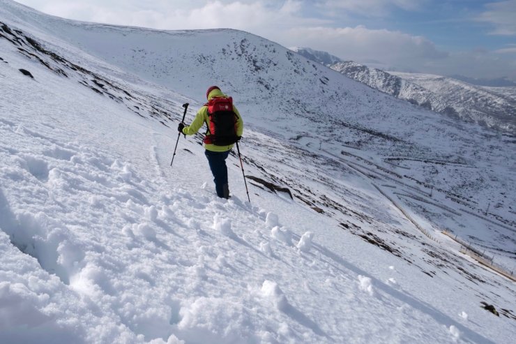
Soft snow in the mild temperatures, some deeper accumulations still persit.
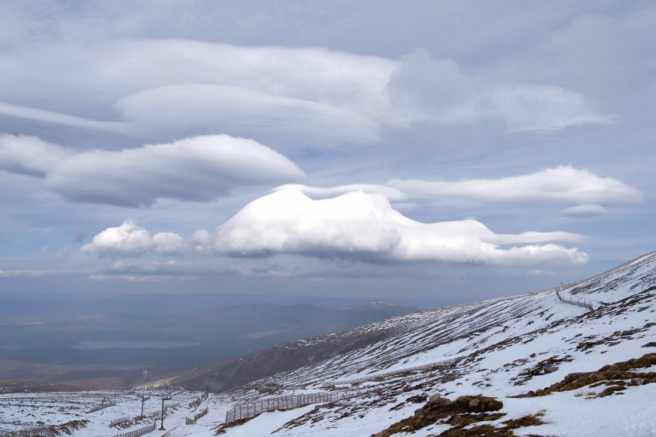
More Lenticular clouds.
Soft snow and roller balls on a North-West aspect at around 1050 metres.
Coire an t’Sneachda
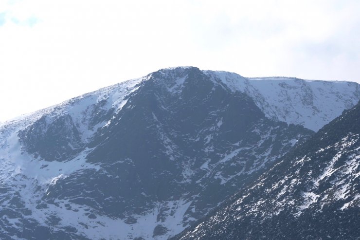
Fiacaill buttress in Coire an t’Sneachda, yesterday rime ice was covering most the crag. Back to Black. (Please note: The contrast on this photo has been boosted to overcome the hazy conditions).
Looking down into the Coire Cas ski area the snow line is now well above 850 metres.
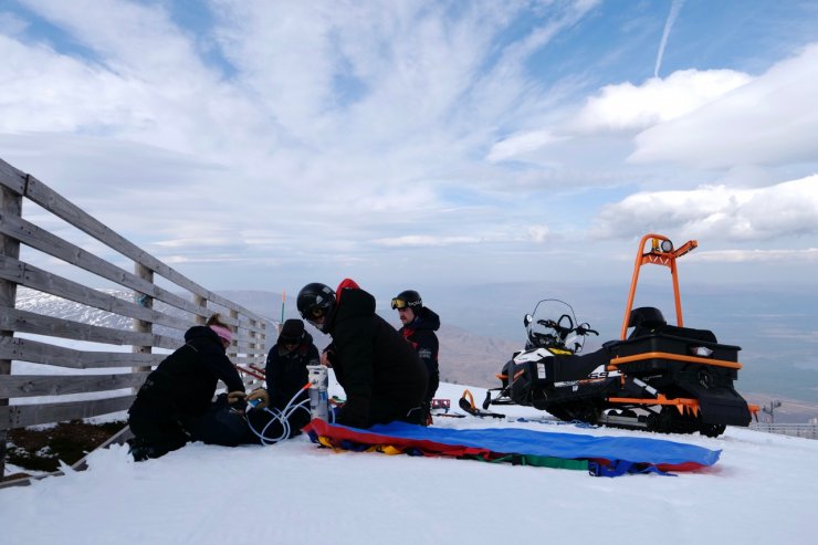
With skiing suspended due to the storm force winds the Cairngorm ski patrol takes an opportunity to do some staff training.
Comments on this post
Got something to say? Leave a comment