Turbo Thaw
22nd March 2025
Overnight gale force Southerly winds, combined with a freezing level above the summits and rainfall has had a severe impact on the snowpack. Little (if any) snow remains below 900m, above this elevation the snow is now restricted to areas where there had been a greater depth.
Very poor visibility (less than 50m) hindered observations and photography today, but the photos below will give you a ‘flavour’ of conditions and what remains of the snowpack.
We are expecting a brief colder spell of weather over the next 24 hours as the wind swings round to the North dropping the freezing level down to around 950m. Rain will turn to snow and we are expecting 15 cm of snow to fall across the Northern Cairngorms region on the higher tops. Some drifting will occur on moderate Northerly winds; developing fresh windslab instabilities on South-East to South-West aspects above around 1000m.
The freezing level is set to rise above the summits again from Monday onwards.
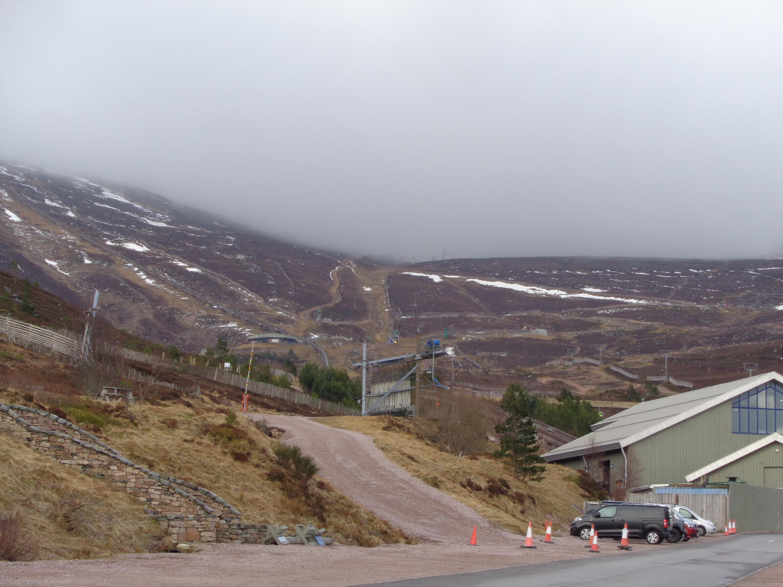
Looking up into Coire Cas from the ski centre carpark. The cloud level was around 850m. The only snow remaining on this Northerly aspect following the overnight ‘turbo thaw’ are areas in the leeward side of snow fences where the snowpack would have gained depth.
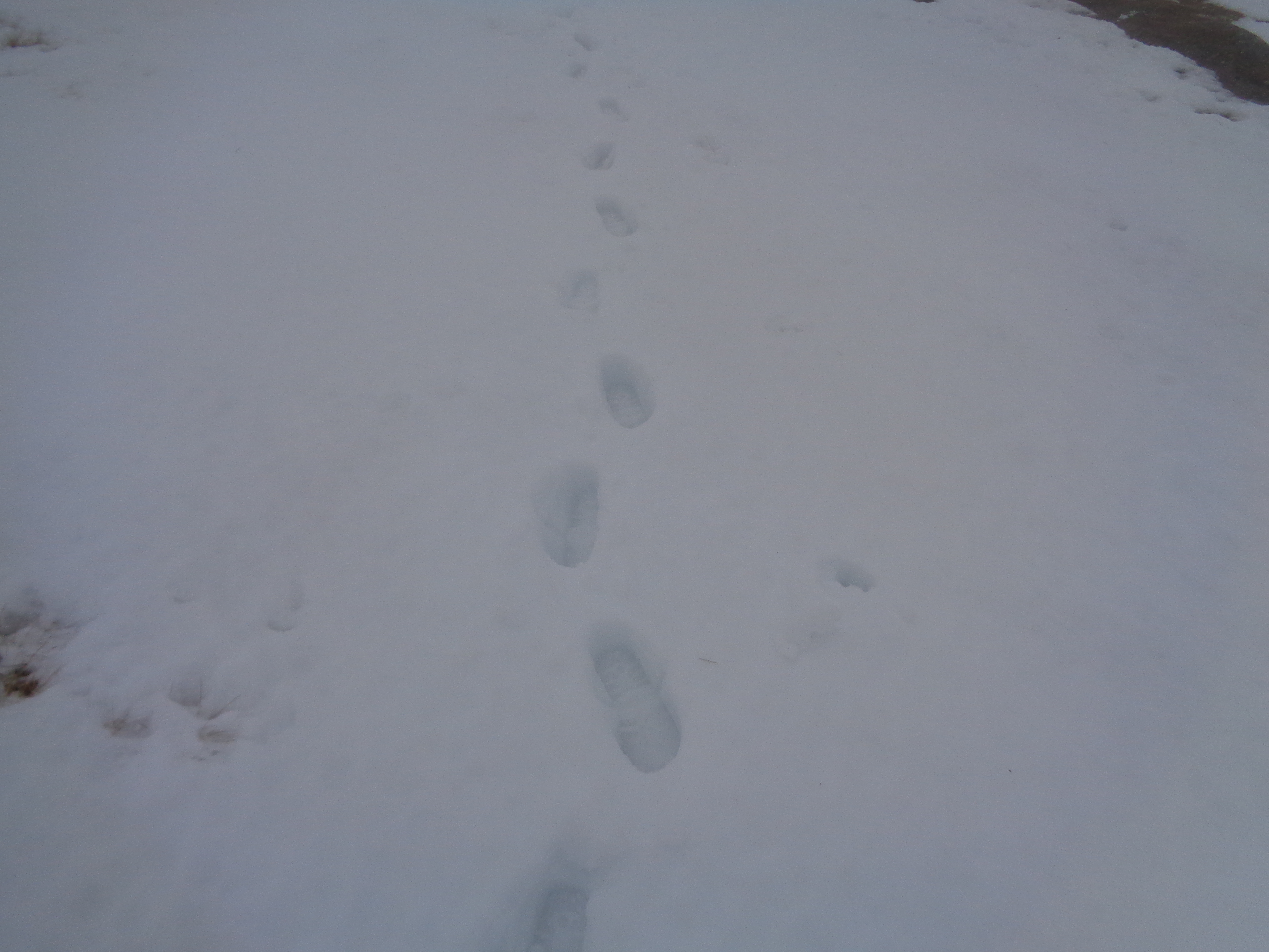
‘Footprints in the snow.’ This photo taken on an Easterly aspect at 1100m. The snowpack was moist/damp/wet….. at all elevations. Occasionally, I came across patches of firmer snow which would have been areas of snow which pre-dated the most recent snowfall event. These were really obvious as they had a ‘dirty grey’ look about them with wind blown vegetation debris littering the surface.
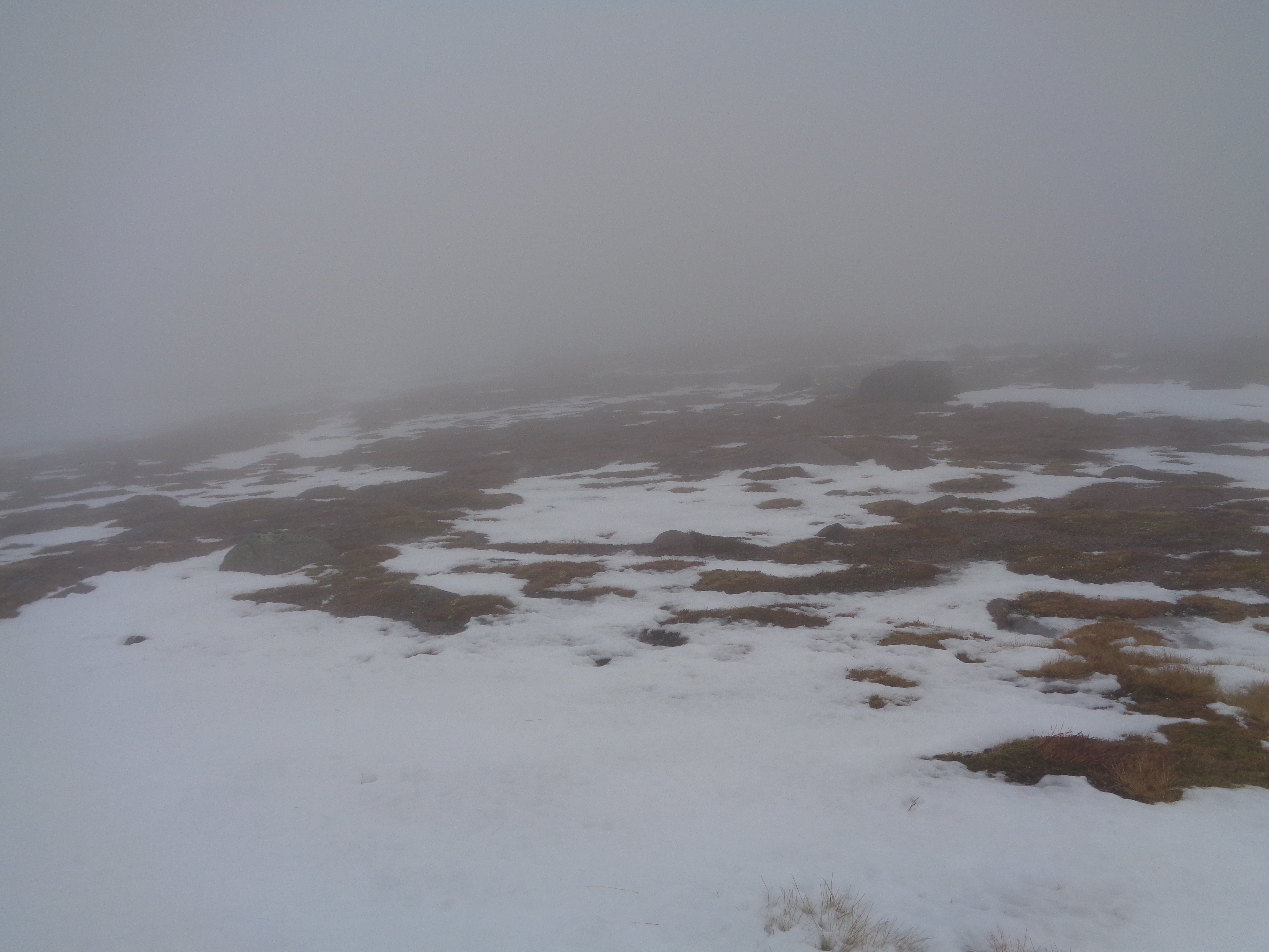
Photo taken around 1200m on an Easterly aspect on Cairngorm, illustrating what remains of the snowpack. There are more extensive snow patches on these E/SE aspects where the ground is steeper and there was a greater snow depth.
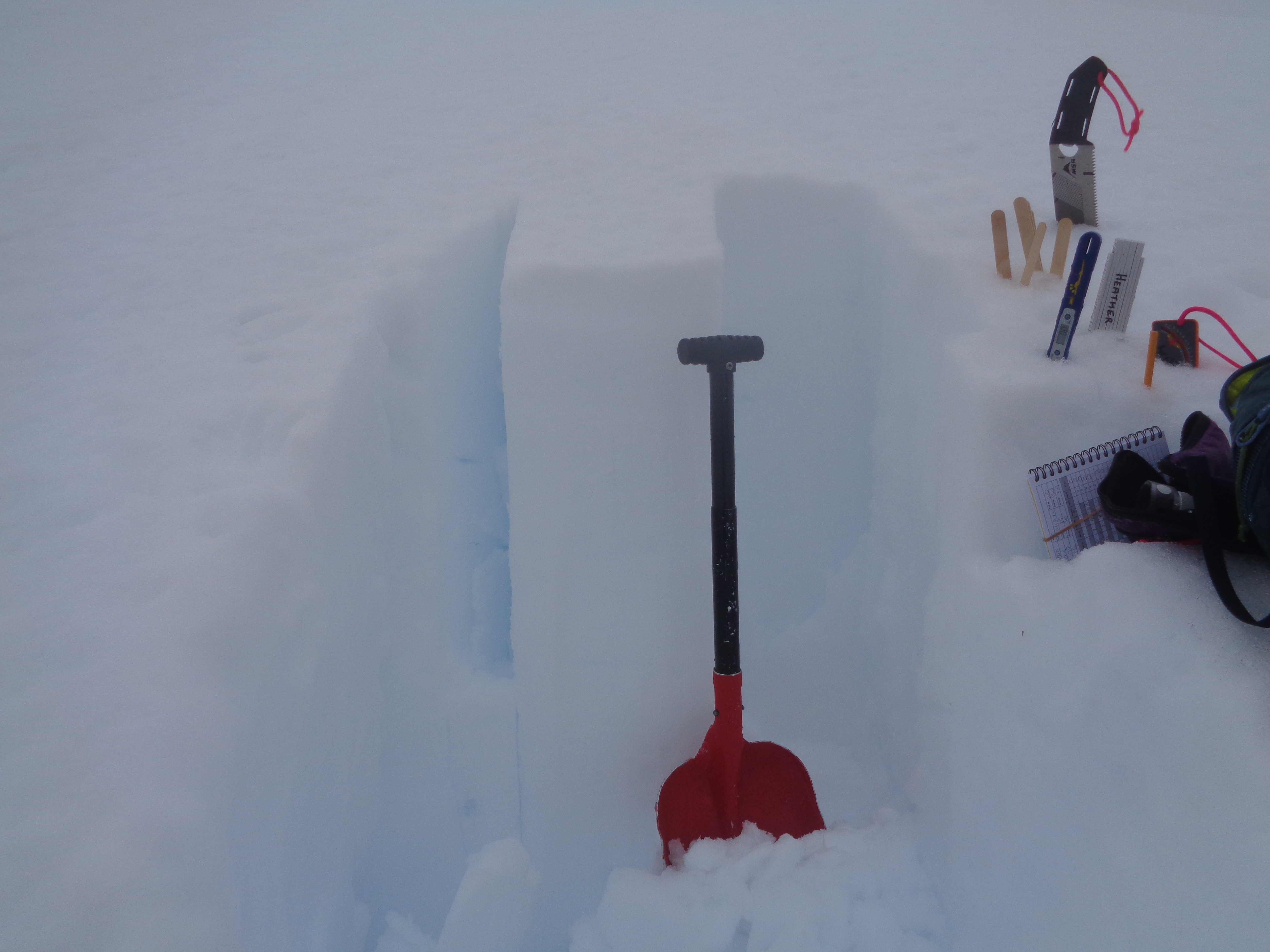
Todays snow profile location at an altitude of 1094m on a SSE aspect on Cairngorm. Here the snowpack was over 1m in depth. This is a stable, moist snowpack with no avalanche hazard.
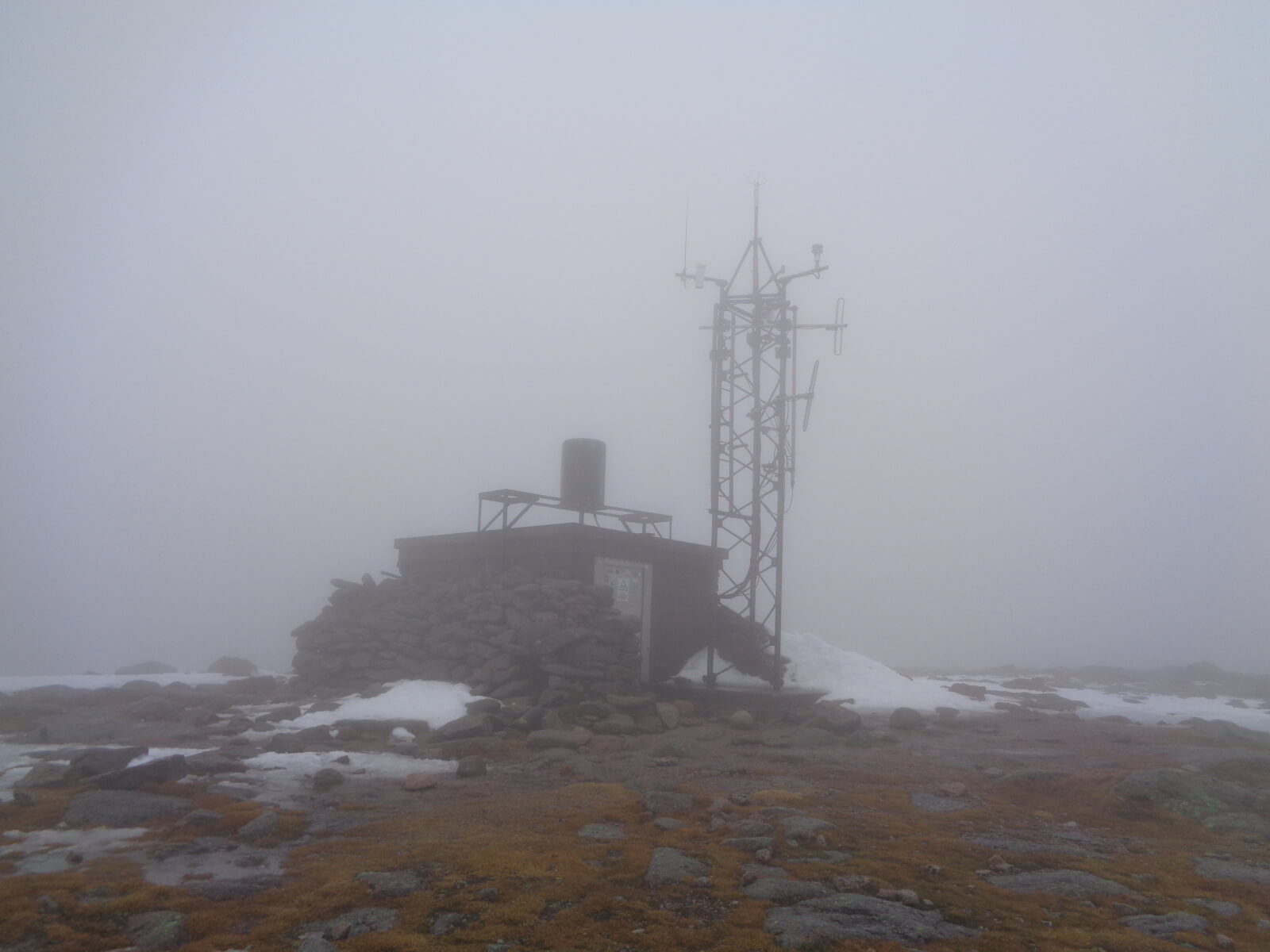
The summit weather station on Cairngorm (locally known as the igloo). The temperature was +3 degrees centigrade.
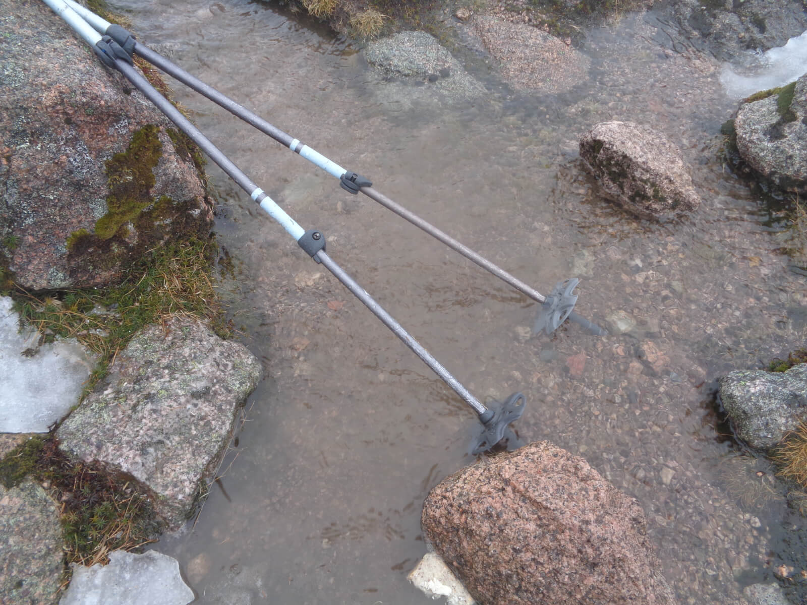
Puddles of water at the summit. The texture on the water looks a bit like ice, don’t be fooled that was the wind creating ripples on the surface of the puddle. The only company on the summit today were the wee snow buntings who seem to be thriving in the Northern Cairngorms, no doubt benefiting from packed lunch scraps.
Comments on this post
Got something to say? Leave a comment


