Storm Force winds…
14th December 2025
The Northern Cairngorms have been battered again by storm force South-South-Westerly winds. These winds have frustrated observations today. Although the weather station data that we receive gives some good information.
The Cairn Gorm summit weather station recorded a maximum gust of 116 mph, with a maximum mean wind of 87 mph. This is over the period from 13th December 1300 GMT to 14th December at 1200 GMT. In Coire Cas we have access to the SIMBA data thanks to the support of Sams Enterprise. Although at the moment it looks like snow may be absent from this site.
Colder temperatures are in prospect for tomorrow, combined with a drop in wind speeds. These colder temperatures will result in firm snow patches, and the potential for ice or verglas on paths and etc. This is most likely above around 850 metres. Isolated snow patches surrounded by bare ground will present a hazard, as any slide is likely to be stopped abruptly by boulders. “Runouts” will be poor.
Many of the easier climbing gully’s may remain unbroken, but this isn’t confirmed. The images below will give an impression of general snow distribution:
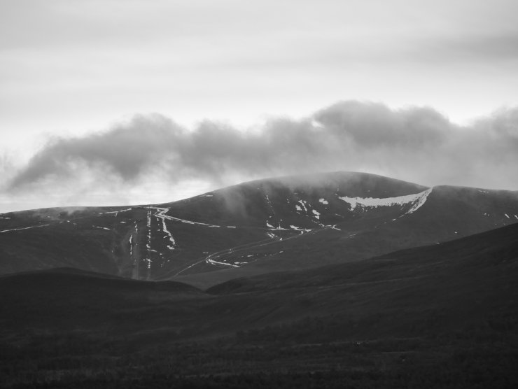
A distant view of Cairn Gorm just after dawn. Note the snow holding along the snow fences of the ‘traverse’ into Coire Cas. The more extensive snow on the right of the image is on the headwall of Coire Cas with Pt 1141 on the right.
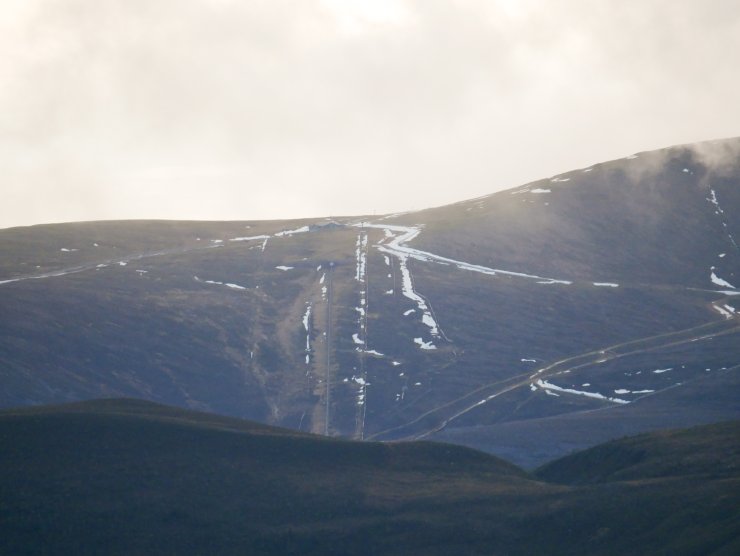
A closer image with the Ptarmigan Station visible in the centre.
A fleeting glimpse of Coire an Lochain on Braeriach. This north facing coire is a cold hole and often holds snow when conditions are absent elsewhere.

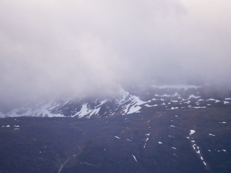
The centre of the picture is the rim of Coire an t-Sneachda. Still holding snow in anticipation to the colder temperatures tomorrow.
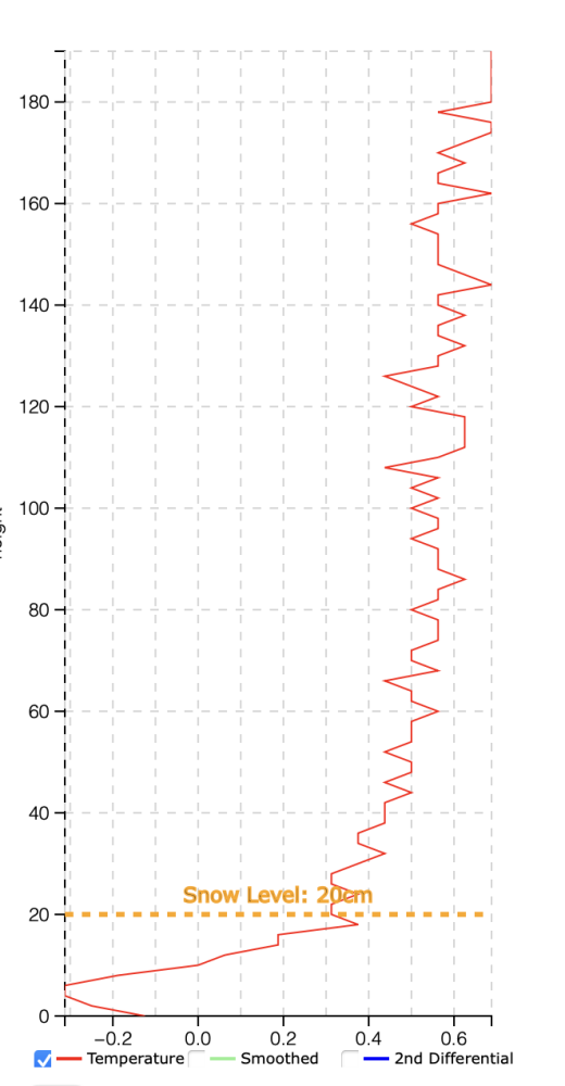
Coire Cas SIMBA Data. Generously supplied by Sams Enterprise (copyright). The snow may have largely gone from this site, although these may be some snow and ice close to the base of the sensor chain. In deeper snow this allows us to see temperatures through the snowpack. Ultimately this gives an indication if the snowpack is stabilising or potentially becoming weaker.
Comments on this post
Got something to say? Leave a comment


Phill Thompson – SAMS Enterprise
16th December 2025 10:14 am
Glad we can continue to support SAIS by providing additional snow data, and we are grateful to SAIS for their continued support over the years.
ncairngormsadmin
16th December 2025 1:28 pm
Thanks for the message Phill. Just need some fresh snow…