More snow on the horizon
25th January 2026
The South-Easterly flow looks set to continue feeding in outbreaks of snow in the mountains. In the Northern Cairngorms area snowfall is expected for most of the forecast period tomorrow, although amounts will be difficult to verify in the gale to storm force winds.
Visibility was challenging again today, making observations difficult. The windslab present above 850 metres is humid and suggestive of slow consolidation. However, shooting cracks are readily achieved around small wind lips and breaks of slope indicating both weaknesses below the windslab, combined with propagation. This indicates that there is the potential for larger avalanches. Particularly in steep locations such as coire headwalls, coire rims and in gullies.
This will remain a concern, particularly as the windslab has become firm. These windslabs may be stubborn to trigger under the weight of a person, but firmer slabs often create tensions cracks (and their associated crown walls) up slope entraining people in the debris. On a more positive note windslab accumulations at lower elevations (below 850) seem to be rapidly consolidating.
The steep banks and terrain traps mentioned in yesterday’s blog seem to be at an altitude that is flirting with the freeing level. Accumulations in these locations seem to be very localised, and stabilising quickly. Correspondingly, snow will stick in these locations quickly as temperatures fluctuate. Steep banks and burn lines will remain worthy of consideration in the coming days. The avalanche hazard is Considerable.
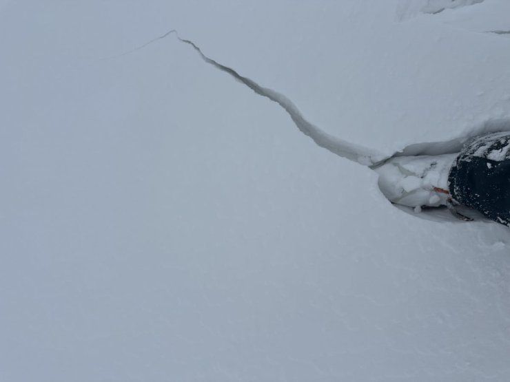
Shooting cracks in windslab at around 1000 metres on a Northerly aspect. This indicates both weakness below and propensity for propagation.
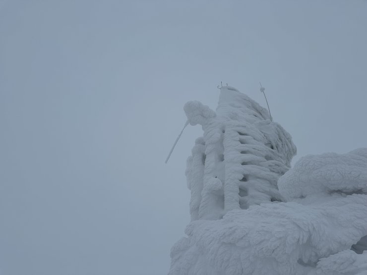
A visit to the weather station on Cairn Gorm at 1245 metres has little to commend it. I can confirm that it was windy, around 50 mph from the East-South-East. Note the radio antenna on the left which appears to be broken and encased with rime ice.
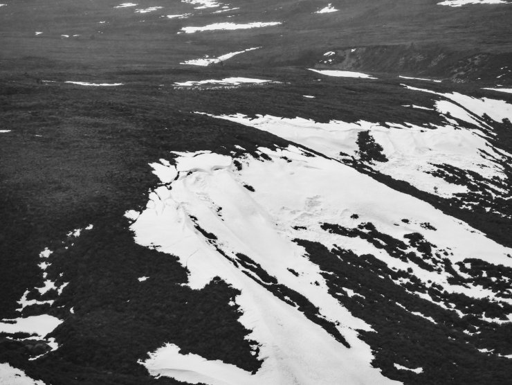
This is a shot looking down from the ski road to the North facing slopes between the Allt a’Choire Chais and the Allt Mhor. At around 550 metres. Of interest here are the cracks at the top of the slope. These are most likely glide cracks indicating a homogenous snowpack i.e. stable, which has been subject to slow ductile creep in thaw conditions. At the bottom of the slope there may also be some old avalanche debris. Both these observations are not pertinent to the current situation higher up the mountain, but do indicate the potential for instability at lower elevations at times.
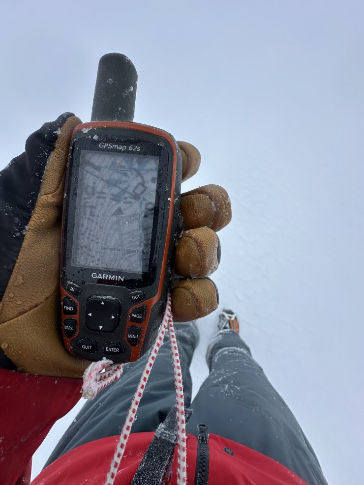
Regardless of the tool, accurate navigation was essential at higher elevations today.
Comments on this post
Got something to say? Leave a comment


Arthur
25th January 2026 6:16 pm
Hi Folks, thanks for all your great work!. My comment not directly related but do we know why MetOffice has not been showing windspeed on its mountain summit forecasts these past few days? I have emailed Metoffice this evening so will no doubt get their reply in next few days.
ncairngormsadmin
25th January 2026 7:05 pm
Hi Arthur, I know they have had some technical problems with windspeed on the Met Office website and app. The specialist forecast that we receive hasn’t been affected, and they are working on a solution. For some reason the live feed from the weather station on the summit we have access to doesn’t seem to be affected either.