Storm Christoph
21st January 2021
Covid -19
The Scottish Avalanche Information Service issues information to support permitted activity under current Scottish Government guidance.
Please be aware of current mandatory travel restrictions in Local Authority areas within Scotland and respect local communities by referring to Scottish Government guidance and safe route choices for exercise. For further guidance please refer to the following information for hillwalkers and climbers and snowsports on ski and board.
This blog is intended to provide hazard and mountain condition information to help plan safer mountain trips.
A delicate situation prevails in the Northern Cairngorms following the arrival of Storm Christoph. Strong to gale force winds have continued to transport snow overnight and through the day. This is expected to continue tomorrow.
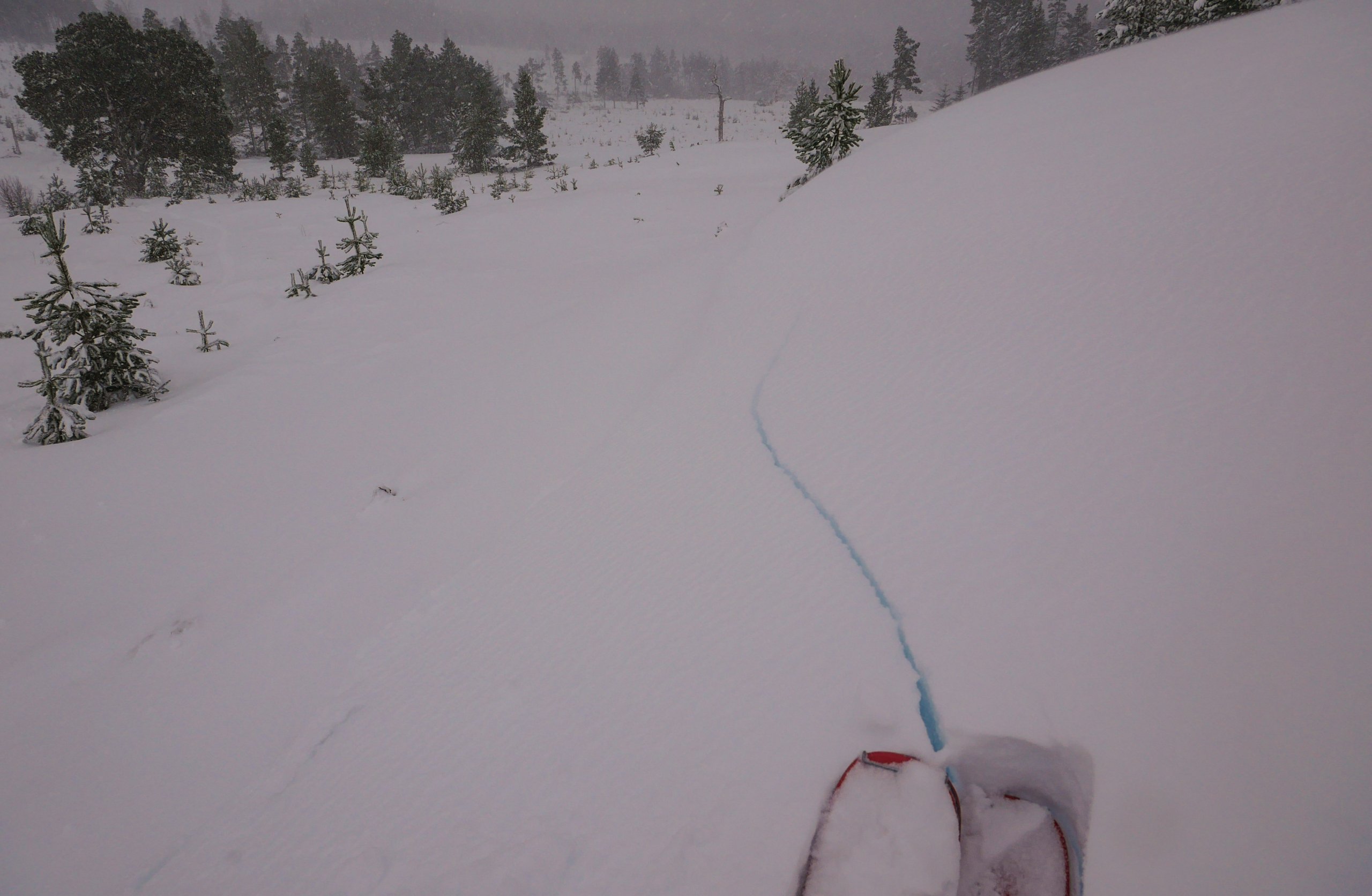
Previously to this there was snowfall which fell under light winds, creating a widespread soft layer (as noted yesterday). This has now become a weak layer under new accumulations of windslab. The presence of this weak layer is demonstrated by the cracks in the snowpack, visible in the images below.
Accumulations of windslab will be present on East to South aspects above 600 metres. Steep wind sheltered locations above 400 metres, e.g. banks and convexities will also form accumulations of windslab on North-East, through South-East to South-Westerly aspects.
Another wild day is in prospect for tomorrow.

More cracking windslab, demonstrating the weakness of the layer underneath.
Cracking windslab, this small convex rollover was an East facing aspect at 490 metres.
Comments on this post
Got something to say? Leave a comment


