Snow Transport
17th December 2022
There has been extensive snow transport today in the Northern Cairngorms. The strong South-Westerly winds have started to redistribute snow from the southerly aspects to mainly the North and North-East aspects.
The most significant windslab accumulations are in wind sheltered locations above 900 metres. However, there is also drifting noticeable at lower elevations down to around 600 metres.
Overnight and tomorrow the winds will change again, becoming Southerly and then backing to the South-South-East by dawn. This will create further accumulations on North-West, North and North-East aspects. Given the gale force winds cross loading will also occur onto West and East aspects, and there may be accumulations at low elevations. There is a huge reservoir of relatively soft snow to be transported from the high plateaus of Beinn a’Bhuird in the Southern Cairngorms forecasting area.
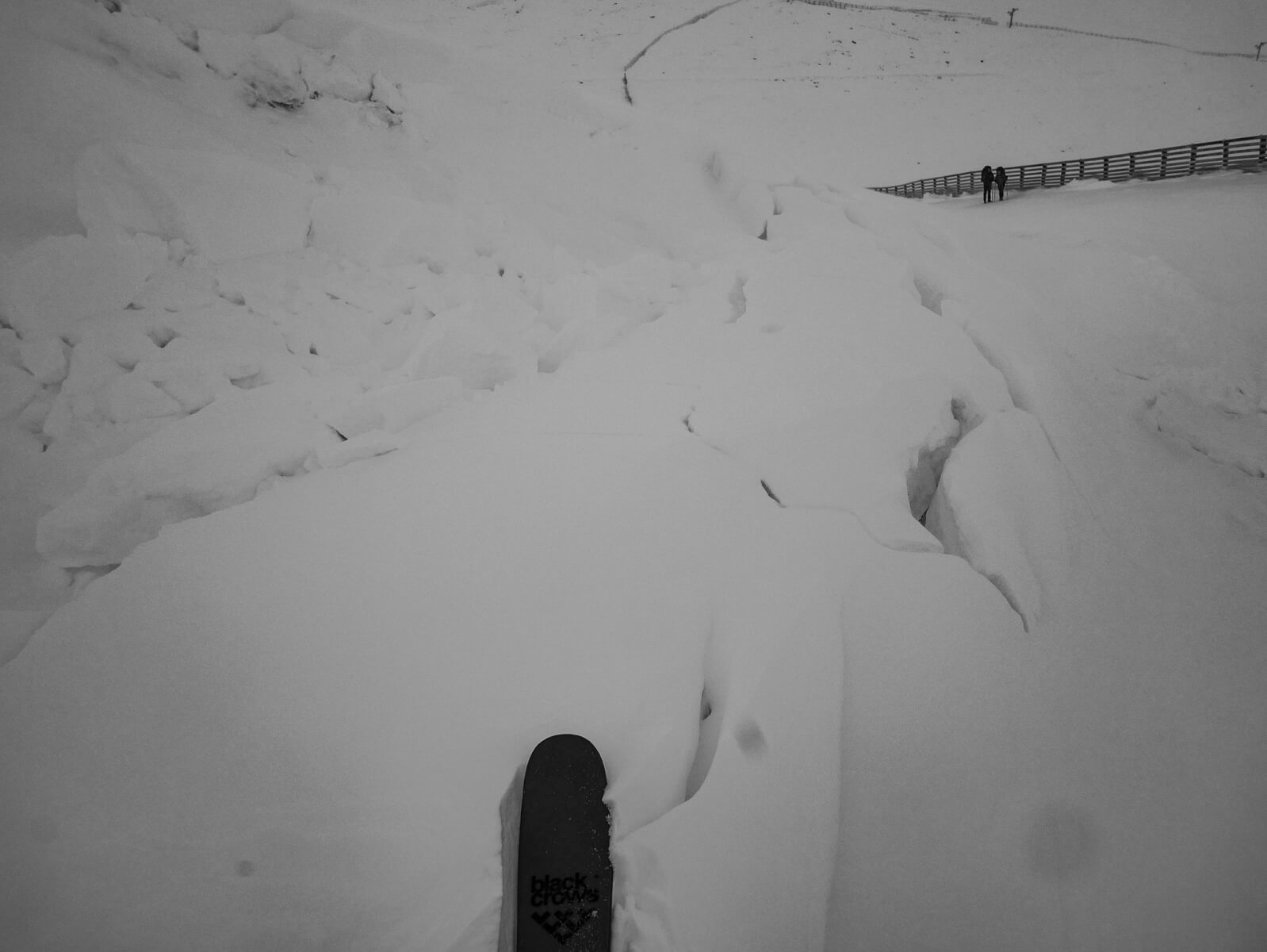
Today was not without interest. I remote triggered a windslab avalanche from 50-100 metres away, which was around size 2. I came off skis and sunk into new windslab to just above the knee. Immediately, I triggered a weak layer under my feet with an audible whoopmf.
I was on a small convex roll of 26 degrees, but the failure propagated across the slope into steeper terrain with greater snow depth. The crown wall was greater than 1 metre in height and located close to the coire rim (see pictures below). This avalanche was significant as it went to the ground. There was also evidence of an avalanche over night in Coire Cas.
You do have to take evidence of instability when you can get it, the avalanche hazard is Considerable.
This small steep slope is North facing and lies just above the Zig-Zag track in the ski area. It is probably around 850 metres in altitude, but had already built a decent slab deposit this morning. On my return it had been triggered onto the track. Trigger unknown.

Windslab avalanche remotely triggered by the Forecaster today. Crown Wall may be visible at the top right close to the coire rim.

Snow drift, (also know as snow transport) visible along the ridge line in the picture.

Another view of the windslab avalanche on a North-East aspect at around 1050 metres in Coire Cas. Note the exposed rocks higher up the slope. The crown wall is visible in the centre of the image close to the ridge line.
Comments on this post
Got something to say? Leave a comment


