Snow Transport
23rd March 2023
Another windy day in the Northern Cairngorms with some significant wind transport in temperatures just below freezing. Despite the spectacle of snow being blown around this morning, windslab development was isolated to the coire rims and headwalls above 1000 metres.
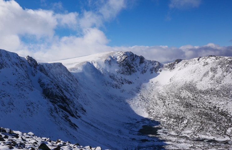
Given the wind direction from the South-South-West there are a couple of areas that frequently receive greater amounts of snow accumulations. One is ‘Y Gully’ in Coire an Lochain and the other is the area between the ‘Goat Track’ and ‘Fiacaill Buttress’ in Coire an t-Sneachda. Debris was noted under Y Gully today, and with no crown wall visible this is anticipated to be from cornice collapse resulting in a loose dry avalanche (picture below).
Tomorrow the wind is likely to be strong rather than gale or storm force but will be an ideal speed for further windslab development. As such North-West through North to East aspects above 1000 metres will be the most likely locations for new windslab exhibiting weaknesses. The avalanche hazard will be Moderate.
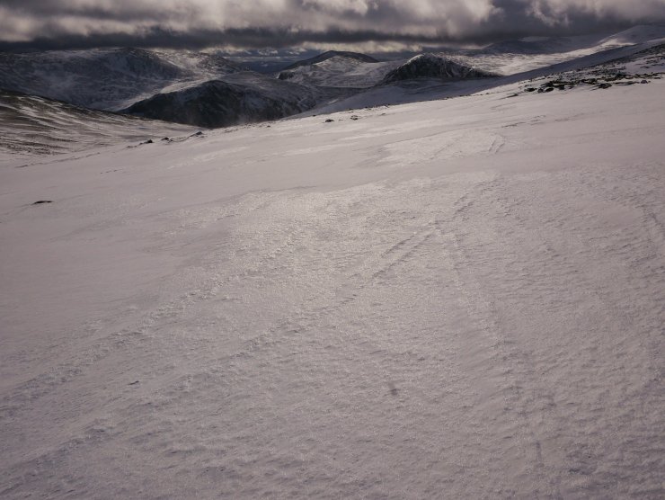
Good cover remains on plateau areas, but it was firm and icy in many locations. Although it did start to soften a little later.
A view into Coire an t-Sneachda and Fiacaill Buttress. The wind was moving quite a bit of snow, seen here centre left flowing down ‘The Goat Track’. Despite this windslab accumulations were generally isolated and shallow in depth.
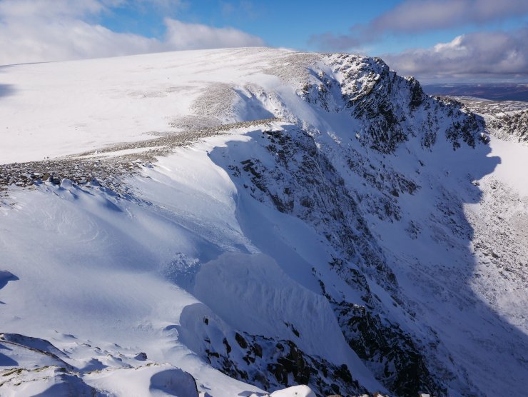
Fresh but small cornice development above Central Gully, Coire an t-Sneachda.

Avalanche debris noted from Y Gully, Coire an Lochain. Thanks to off duty SAIS Observer (JS).
Comments on this post
Got something to say? Leave a comment


