Increasing SE winds
30th December 2023
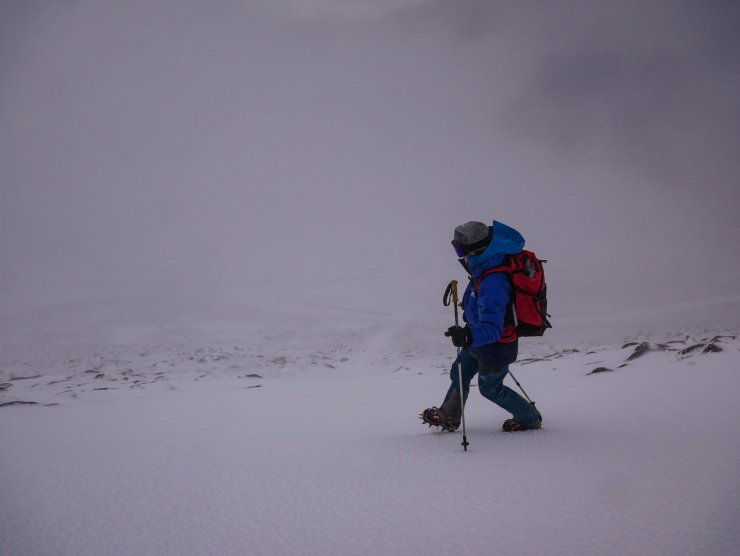
The weather today deteriorated rapidly around midday as the winds veered to the South-East, increasing to storm force. The Coire Cas bowl is well known for being infernal in these conditions as snow is blown down to lower elevations, bringing blizzard conditions.
Many parties were observed to have made an early start climbing or skiing before making their way out of the mountains prior to the worst of the weather. Later a few hardy souls were making use of Cairngorm Mountain’s beginners area, while others rapidly extracted themselves to the vehicles parked nearby. However, the same conditions that have curtailed activity today should fill in the ski area nicely with snow tomorrow.
Poorly bonded windslab was deposited as the day progressed, particularly in the afternoon. Accumulations are expected to become more widespread overnight and through the day, as the wind transports snow creating windslab deposits in steep sheltered locations. The avalanche hazard is Moderate.
A few images are included below. Further down the blog well below the fold you will find some musings on wind.
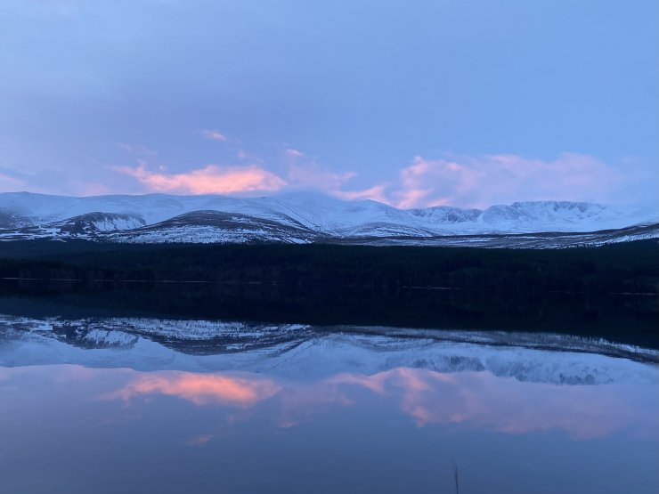
A bright start to the morning in the Northern Cairngorms. The red sky in the morning perhaps an indication of the approaching front and storm force winds that arrived in the afternoon.
A slight change to the contrast in the this image brings out the icy rain crust in the foreground. This gives a firm and consequential travel surface in many locations. Factoid: In the centre of the image a strip of snow is visible running down towards the snow fences. This is reputed to be the line of an incline used by Quartz diggers to remove semi precious ‘Smoky Quartz’ for which the Cairngorms was/is famous. Hardly visible in the summer, the line is obvious with the additional contrast that the accumulation of snow brings…
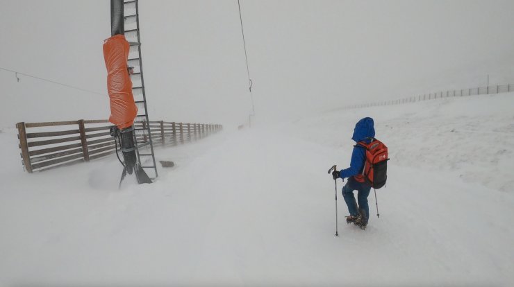
The battery gave out on the GoPro today leaving this one solitary image of the snow blowing around in Coire Cas as the weather deteriorated just after midday. Snow was being blown down to lower elevations were accumulations of windslab were evident in wind sheltered locations. It will almost certainly have developed at higher elevations in very steep wind sheltered locations later in the day.
Wind – Wind is very interesting, particularly for avalanche forecasters and we talk about the perceptible movement of the air frequently and in different contexts. Why? First and foremost we are interested in the effect that the wind has on the snow, moderate and fresh wind speeds result in the drifting of snow, followed by erosion and redistribution. In storm force winds snow is lost into the atmosphere in some cases, or results in erosion of the snowpack downslope even in lee (sheltered) areas.
But anybody who has survived high winds on the Cairngorm Plateau, might (quite rightly) take the view that the effect of wind on people is perhaps more relevant. Many terms are used to articulate how the wind may be felt on an individual, but I have always been interested in the figures.
Initial research has produced some interesting figures on the effect of wind on people in urban building developments, Arctic trails of Royal Navy vessels, and the effect of helicopter rotor downwash. More on this tomorrow…
Comments on this post
Got something to say? Leave a comment


Siobhan
31st December 2023 2:33 am
Quartz did you say??
ncairngormsadmin
4th January 2024 3:19 pm
There are differences of opinion as to this feature. But one forecaster is definitely in the Quartz Diggers camp.
tim
31st December 2023 4:11 pm
Happy New Year to you all. Love your pictures. Stay safe
ncairngormsadmin
3rd January 2024 5:03 pm
Happy new year to you too!