Calm and Wintry
24th February 2024
Today was calm and mainly dry with the odd passing wintry shower. A glance back at Tuesday’s blog highlights how much whiter the mountains are now looking, following 3 days of cold and showery weather. Over the last 3 days very little snow was forecast for the Cairngorms but a few more showers have reached the Cairngorms than expected, and each passing shower has contributed to the overall accumulation. Initially the snow showers came on strong South-Westery winds, causing unstable windslab to build on North to East aspects above 1000 metres. However, the passing snow showers over the last 24 hours have fallen when there was little wind, resulting in a thin covering of loose snow lying across all aspects (perhaps ready to be redistributed when the wind next picks up).
This thin covering of fresh snow now disguises the old snow underneath, which remains firm, and could have serious consequences in the result of a slip or a fall. It also makes it harder to identify the windslab, which will remain above 1000 metres.
Little change is expected for tomorrow with another dry, bright and calm day forecast.
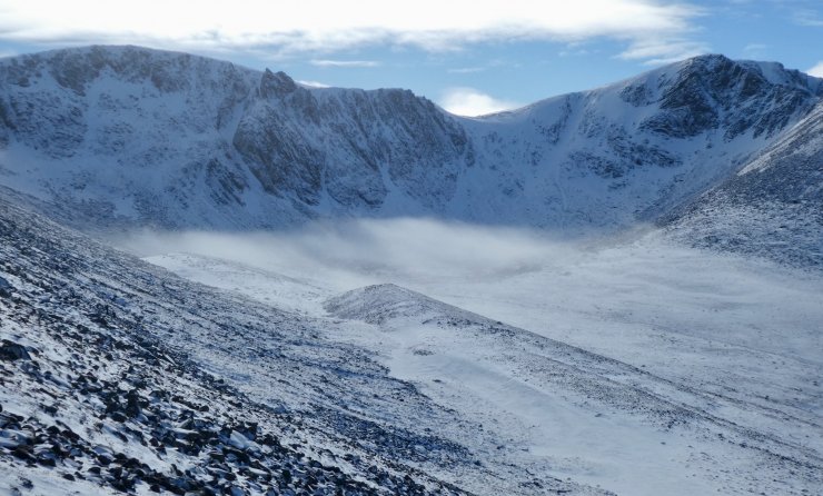
Coire an t-Sneachda. 5 minutes prior to the photo being taken the coire was engulfed in clouds. The clouds parted to reveal some wintry looking crags.
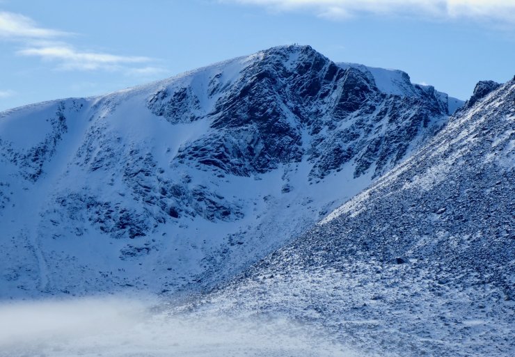
Fiacaill Butress in Coire an t-Sneachda with a few people on the top.
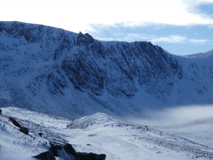
A closer view of Aladdin’s Butress.

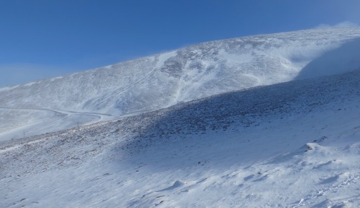
The outline of the Goat Track is visible running from bottom left towards the centre of the photograph. How many people can you spot?
The West facing Coronation Wall in Coire Cas, now with a very thin covering of fresh snow.

Although the hills look much more wintry than 3 days ago, this distant photo highlights that it is only a thin covering of fresh snow.
Comments on this post
Got something to say? Leave a comment


